July 27, 2017
WHAT’S THE SANCTUARY OYSTER REEF LOOK LIKE?
How is the Sanctuary Reef Doing?
Enquiring minds want to know. Yet, the question isn’t easy to answer. We have done bottom samples along the reef and can tell that the top layer has live oysters and seems healthy. Still, it is hard to understand how the reef is growing and how tall the oyster part of the reef has grown. Eventually, we will need a research scuba diver to survey the reef in the winter when the water is clear.
In the meantime, we are fortunate that Nautical Solutions International Inc (NSI Inc.) is our neighbor across the parking lot from the Federation. They own a side sonar and the charting software necessary to represent the reef as a 3D model. Their company not only helps survey for living shorelines and waterways that need to be dredged, but they also help chart new island topography in Hawaii (which is changing due to lava flow) and have helped identify shipwrecks. They even helped with an FBI murder investigation!
We hired NSI Inc. (thanks for the neighborly rate!) to survey the reef and the shoreline along Turnbull Estates where we are installing a living shoreline and hope to include oyster reef balls. We needed a very detailed survey of the shallows along the shoreline to figure out if the oyster reef balls needed to be installed from a boat or from the shore.
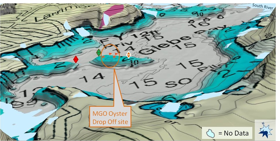
The above image shows a 3-dimension rendering of the NOAA chart of the South River Oyster Sanctuary Reef where our 80 Marylanders Grows Oysters (MGO) drop off the oysters they care for during their first year of life. The reef was placed on a sand bar island in 2 feet of water. Substrate was put down to keep the oysters from sinking into the bottom and suffocating.
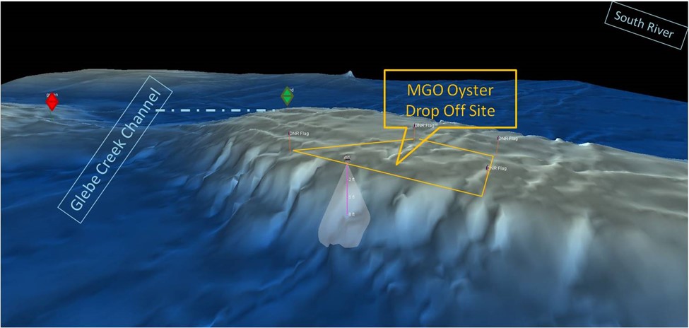
This image shows the underwater topography (shape) of the reef. The side sonar showed that not only were oysters growing on the flat plateau in 2 feet of water, but also it appears they have colonized the drop off from 2 feet to 14 feet, making a wonderful vertical wall of oysters.
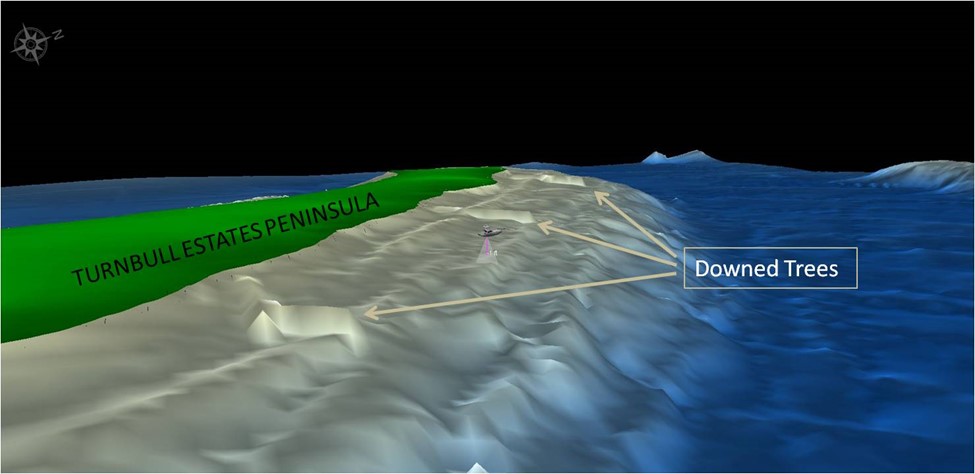
This side sonar shows the very shallow water off Turnbull Estates, where we will be building a living shoreline. We needed to figure out where and how we would place the oyster reef balls and needed a more detailed underwater topography to make logistical decisions. We were surprised that the side sonar was so detailed it even picked up the down trees that have fallen into the water due to erosion.